A Western Disturbance is over the eastern parts of Jammu and Kashmir. This system is moving away eastwards. Its induced Cyclonic Circulation is over Punjab and Haryana. A Trough is extending from this system up to Bihar across Uttar Pradesh. Rain and snow may continue in most parts of the Western Himalayas until the afternoon of January 29. A few heavy spells are also likely. Meanwhile, moderate rain with isolated heavy spells may lash North Punjab, Haryana and West Uttar Pradesh. Meanwhile, scattered rains are likely in Delhi, rest Punjab, Haryana and in one or two parts of North Rajasthan.
In East India, the rainfall activities will increase in East Uttar Pradesh, Bihar, Jharkhand, Odisha and Gangetic West Bengal. But, isolated rains are expected in Sub Himalayan West Bengal, Sikkim and northeastern states. Day temperatures may drop by 3-4 degrees celcius in eastern parts of the country while minimums may increase by 2-3 degrees celcius.Kolkata, Ranchi, Jamshedpur and Bhubaneswar may receive moderate rains. Light showers are likely in Varanasi, Prayagraj, Patna and Gaya.
Click the image below to see the live lightning and thunderstorm across India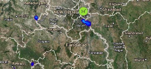
Talking about Central India, a Trough is extending from Bihar to South Chhattisgarh. Therefore, scattered rains are likely in Chhattisgarh, parts of Vidarbha and East Uttar Pradesh. Nagpur and Chandrapur may see these rains. On the other hand, Rajasthan, Gujarat and West Madhya Pradesh may remain dry only. Minimums of West Rajasthan, Gujarat, Madhya Maharashtra and North Konkan and Goa including Mumbai and Ahmedabad will fall by 3-5 degrees Celcius.
Down South, due to to a Confluence Zone over Telangana and Coastal Andhra Pradesh, isolated light rain is likely in North Telangana, North Coastal Andhra Pradesh. On the other hand, the weather of Tamil Nadu, Karnataka, Kerala and Rayalaseema will be dry. The cities of Chennai, Bengaluru and Hyderabad will be dry only.
Any information taken from here should be credited to skymetweather.com


