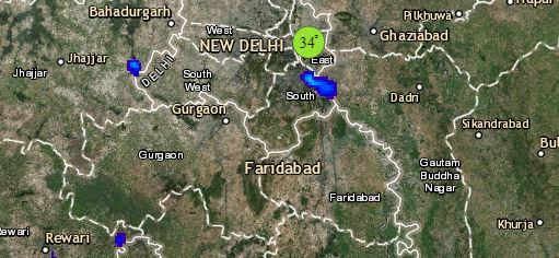
Beginning with North India, a Western Disturbance is over Jammu and Kashmir. Its induced Cyclonic Circulation is over Punjab and adjoining area. A Trough is extending from this system up to East Uttar Pradesh. Thus, fairly widespread rain and snow may lash Jammu and Kashmir, Ladakh, Himachal Pradesh and Uttarakhand. Meanwhile, rain and thundershowers are likely in many parts of Punjab, Haryana, West Uttar Pradesh, North Rajasthan. Scattered showers are also likely in Delhi and NCR.
In East India, scattered light to moderate rain is likely in parts of East Uttar Pradesh by the evening of January 28. Odisha and parts of Jharkhand may also witness scattered rainfall activities. On the other hand, the weather of West Bengal and Bihar will remain dry. Meanwhile, due to a Cyclonic Circulation over Bangladesh and Meghalaya, scattered rains are possible in Assam, Meghalaya and Arunachal Pradesh. The weather in Kolkata may remain dry only.
Click the image below to see the live lightning and thunderstorm across India
Moving towards the central parts of the country, a North-South Trough is extending from East Uttar Pradesh to South Chhattisgarh across East Madhya Pradesh. Isolated light rain is likely in Chhattisgarh and North Madhya Pradesh. Another Trough is extending from South Rajasthan to North Arabian Sea across Gujarat. Therefore, isolated thundery activity or light rain is likely in South Gujarat and North Konkan and Goa. On the other hand, the weather of South Rajasthan and West Madhya Pradesh may remain dry. Mumbai may witness cloudy sky with thundery activity.
Down South, in the absence of any significant weather system, the southern parts of the country will be dry. However, isolated thundery activity is likely in Coastal Andhra Pradesh and Karnataka Coast. Minimums may increase in Telangana and Andhra Pradesh. The cities of Chennai, Hyderabad and Bengaluru will observe dry weather only.
Any information taken from here should be credited to skymetweather.com


