To begin with North India, dry and cold winds from north-west are blowing over the entire north-west India. Therefore, we expect dry weather conditions to continue with further fall in day and night temperatures. Cold Wave conditions will cover some more parts of Punjab, Haryana, Uttar Pradesh, North Rajasthan.
Drop in temperature may lead to formation of ground frost in many parts of north-west plains. The moisture will decrease reduction in intensity of fog, but the pollution levels will continue to remain in very poor to severe category in Delhi. Winter in Delhi may worsen as temperatures are all set to fall further.
Heading towards Central India, Cold Wave conditions have abated from Vidarbha and adjoining areas, but now cold north-westerlies are reaching the regions of Gujarat, Madhya Pradesh, Maharashtra and Chhattisgarh. Therefore, we expect temperatures to fall in these areas and isolated pockets of Gujarat and Madhya Pradesh may come under the grip of Cold Wave conditions. Weather to remain dry over pan Central India.
Down South, a trough is extending to North Interior Tamil Nadu across Telangana and South Interior Karnataka. This system can give isolated light rains over Andhra Pradesh, Tamil Nadu, Kerala and South Interior Karnataka. Since the intensity of these rains will be light to very light, temperatures will not be much affected.
Click the image below to see the live lightning and thunderstorm across India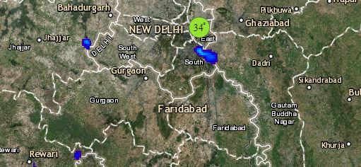
Moving to East/Northeast India, cold winds are blowing over East Uttar Pradesh, parts of Bihar, Jharkhand and many parts of Odisha and West Bengal. Hence, marginal drop in day and night temperatures is possible. Northeast India will also experience dry weather conditions. Shallow to moderate fog is possible in parts of East Uttar Pradesh, Bihar, parts of Meghalaya and Tripura.
Any information taken from here should be credited to skymetweather.com


