Monsoon continues to be active over East India; all thanks the fresh low pressure over North Odisha. The system would cause heavy to very heavy rain over Odisha, Jharkhand, parts of Bihar and Gangetic West Bengal during next 34 hrs. Kolkata may have moderate rains. Meanwhile, East Uttar Pradesh would report light to moderate spells.
In Northeast, the intensity of rain would decrease over Assam, Meghalaya, Arunachal Pradesh and Nagaland, however good rain may continue over Manipur, Mizoram and Tripura.
Moving onto Center of India, the axis of Monsoon trough is passing through Madhya Pradesh and Chhattisgarh. With this, light to moderate rain with few heavy spells are likely over East Madhya Pradesh, Chhattisgarh and parts of Vidarbha. Moreover, the rain intensity is all set to increase over West Madhya Pradesh and Southeast Rajasthan. Also, Konkan & Goa including Mumbai may see light to moderate rains.
Further along the West Coast, the active Monsoon surge over Coastal Karnataka and Kerala would give moderate to heavy rains. Meanwhile, on east coast, Coastal Andhra Pradesh and parts of Telangana may have light to moderate rain with one or two heavy spells.
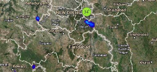
Click the image below to see the live lightning and thunderstorm across India
Finally up North, the western end of the axis of Monsoon trough has shifted south, therefore intensity will reduce but few moderate to heavy showers at isolated places over Jammu & Kashmir, Himachal Pradesh and Uttarakhand cannot be ruled out.
Meanwhile in plains, light to moderate rain with few heavy spells will occur over West and Central Uttar Pradesh, with scattered activities over parts of Punjab, Haryana and Delhi.
Any information taken from here should be credited to skymetweather.com


