To begin with North India, a Western Disturbance is likely to approach the hills of North India during the next 24 hours. At present, dry winds are prevailing over entire North India. Therefore, dry weather with partly cloudy sky is expected over Jammu and Kashmir, Himachal Pradesh and Uttarakhand, barring few higher reaches wherein rain and snow may occur. Similarly, dry and cool weather with clear sky will also prevail over Punjab, Haryana, Delhi, North Rajasthan and West Uttar Pradesh.
Moving to East/Northeast India, a cyclonic circulation lies over Arunachal Pradesh and adjoining East Assam. A confluence zone is extending from North Bengal to central parts of the country across Jharkhand. Therefore, we expect light to moderate rain and thundershowers over Arunachal Pradesh, Assam and few parts in rest northeastern states. Isolated rains with strong winds and lightning strike may also occur in parts of Gangetic West Bengal, Jharkhand and Odisha.
In central India, due to the prevailing confluence zone, Chhattisgarh, East Madhya Pradesh and Vidarbha will receive rain and thundershowers in few pockets. Gradually, these weather activities will increase. Southwest Madhya Pradesh and Gujarat will witness rise in day temperatures.
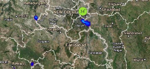
Click the image below to see the live lightning and thunderstorm across India
Lastly in South India, dry weather will prevail over most parts. However, hot weather is likely over Rayalaseema adjoining Telangana and parts of Karnataka. Isolated thunderstorm is possible in parts of North Telangana and North Karnataka.
Any information taken from here should be credited to skymetweather.com


