The Western Disturbance after giving moderate to heavy rains and snow over the hills of North India has now moved away. But the remnants of this system would continue to give light to moderate rain and snow with one or two heavy spells over Jammu and Kashmir, Himachal Pradesh and Uttarakhand.
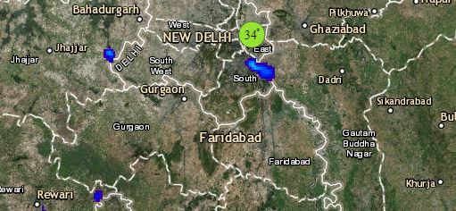
Scattered rain and thundershower activities can also be seen over the foothills of Punjab, Haryana and Northwest Uttar Pradesh. Minimums of many parts of Punjab, parts of Haryana, Delhi and West Uttar Pradesh would rise further, while they would drop in West Rajasthan by one to two degrees.
Talking about pollution, the pollution levels in Delhi and neighboring states would oscillate in very poor to severe category.
Entire Central India would continue to witness dry weather conditions with minimums rising further over Madhya Pradesh, Chhattisgarh and parts of Maharashtra. The Cold Wave condition which were prevailing over Madhya Maharashtra, Marathwada and Vidarbha would ease down a bit due to rise in minimums. However, minimums of West Gujarat might witness a marginal drop due to commencement of cold and dry northerly winds.
Dry weather would prevail over East and Northeast India. The minimums over East Uttar Pradesh, Bihar, Jharkhand and West Bengal would rise by 2°C-3°C.
href="https://www.skymetweather.com/lightning-and-thunderstorm-across-india-live-status/">
Down South, humid winds from Bay of Bengal would continue to blow over most parts of South Peninsula, therefore we expect marginal increase in minimums over Telangana, Andhra Pradesh and Interior Karnataka. Dry weather to prevail pan South Peninsular region.
Any information taken from here should be credited to skymetweather.com


