Down South, a Trough is extending from southeast Arabian Sea to Northeast Arabian Sea and northeasterly winds have picked up pace over Tamil Nadu coast. Therefore, rain activities will increase over Tamil Nadu and parts of Kerala. There will be light rain with one or two moderate spells over these regions. While Lakshadweep may also see moderate spells. However, the weather of Telangana, Karnataka and Andhra Pradesh may be dry. Whereas Chennai and Kochi may witness light rains.
Meanwhile in Central India, an Anti-Cyclone is over Odisha and due to this Anti-Cyclone southeasterly humid winds are reaching Vidarbha and Madhya Pradesh and they are merging with dry and cold northwesterly. In wake of this confluence zone, scattered rain and thundershower activities are possible over Madhya Maharashtra, Vidarbha and parts of Madhya Pradesh. Weather of Chhattisgarh, Gujarat and South Rajasthan will be dry.
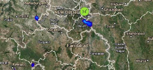
Click the image below to see the live lightning and thunderstorm across India
Up in the North, cold winds from the northwest direction will continue over the plains of the country. Fairly widespread moderate to dense fog is possible over Punjab, Haryana, North Rajasthan, West Uttar Pradesh and Delhi leading to cold day conditions.
The weather over hills will be dry, however isolated thundery activity may occur over the northern parts of Jammu and Kashmir. Delhi pollution will continue to be in poor to very poor zone.
Lastly there is no significant weather system over East and Northeastern states of our country. Isolated pockets of Tripura Meghalaya may witness fog. While Jharkhand, West Bengal and Odisha may see mist and haze during the morning hours. Kolkata, Ranchi, Patna and Guwahati will be dry.
Any information taken from here should be credited to skymetweather.com


