Starting with Central India, a Low Pressure Area is over North Chhattisgarh and adjoining states of Jharkhand and Odisha. The axis of Monsoon Trough is extending from Northwest Rajasthan to Northeast Bay of Bengal. Now, rains will once again increase over Chhattisgarh and Madhya Pradesh as well as over parts of Vidarbha. Mainly moderate rains are along with one or two heavy spells are possible over these areas. Southeast Rajasthan, parts of Gujarat and Konkan and Goa might experience scattered light to moderate rains. Monsoon will remain subdued over Marathwada, and Madhya Maharashtra. Mumbai city might see some light rains with one or two short spells.
Coming on to East and Northeast India! Here, scattered light to moderate rains are possible over Odisha, Jharkhand, Sub-Himalayan West Bengal and Sikkim. Whereas East Uttar Pradesh and Bihar will receive isolated rains. Monsoon will also remain subdued over Gangetic West Bengal. However, a few localized rain activities cannot be ruled out. Parts of Assam, Meghalaya and Nagaland may receive light to moderate rains. Kolkata will remain mostly dry.
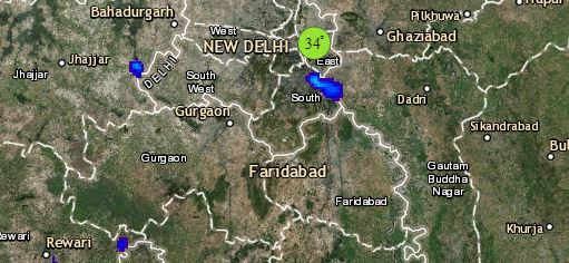
Click the image below to see the live lightning and thunderstorm across India
Talking about South India! Now, the rains activities are expected to reduce over Kerala and Coastal Karnataka. However, light to moderate rains will continue over North coastal Andhra Pradesh. Parts of Telangana may also receive a few short spells of rains. Monsoon will remain active over Andaman and Nicobar Islands where we expect moderate to heavy rains. The city of Bengaluru might receive isolated patchy rains whereas Chennai will remain almost dry.
Lastly in North India! A few moderate spells are possible over Himachal Pradesh and Uttarakhand. Isolated rain activities are possible over foothills of Punjab and West Uttar Pradesh. National Capital Delhi and parts of Haryana may also receive isolated patchy thundery activity during late afternoon and evening hours.
Any information taken from here should be credited to skymetweather.com


