The axis of monsoon trough is currently passing through Firozpur, Patiala, Bareilly, Bahraich, Gorakhpur, Patna, Bankura, Kolkata and further to northeast Bay of Bengal.
During the last 24 hours, Monsoon remained active over parts of Himachal Pradesh, Odisha, West Bengal, Sikkim, Assam, Meghalaya and Arunachal Pradesh.
At the same time, normal monsoon conditions were witnessed over Jammu and Kashmir, Uttarakhand, North Punjab, North Coastal Andhra Pradesh and Interior Karnataka.
In the last 24 hours, major rainfall contribution came from Cherrapunji in Meghalaya that recorded 132 mm of rain, followed by Baghmara 88 mm and Malda 82 mm.
As of September 11, the country wide rainfall is deficit by 7 percent. However, South India is the only sub-division that is rainfall surplus by 2%. Meanwhile, northwest, central and east & northeast India are still rain deficient by 3%, 2% and 24% respectively.
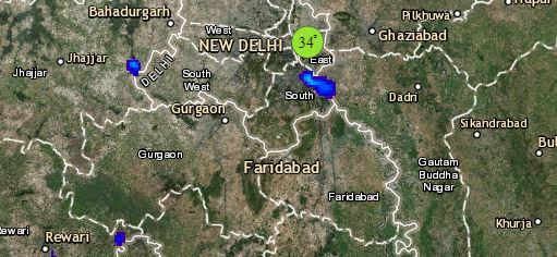
Click the image below to see the live lightning and thunderstorm across India
During the next 24 hours, Monsoon is expected to remain active over Sub-Himalayan West Bengal, Sikkim, Assam, Meghalaya and Arunachal Pradesh, which would give light to moderate rains.
Meanwhile, normal monsoon rains are likely over Southeast Rajasthan, Himachal Pradesh, Uttarakhand, foothills of Uttar Pradesh, North Bihar, parts of Odisha and Jharkhand, Gangetic West Bengal, South Interior Karnataka, Interior Tamil Nadu and Rayalaseema. Rest places will observe subdued Monsoon activities.
Please Note: Any information picked from here should be attributed to skymetweather.com


