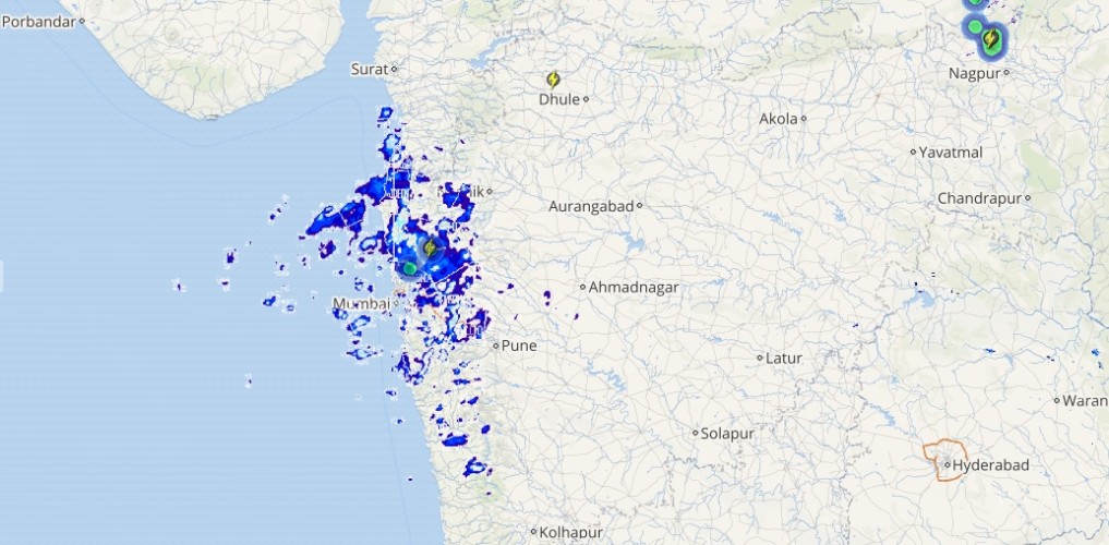
Southwest Monsoon was vigorous over South Rajasthan and Sub-Himalayan West Bengal. While active Monsoon was observed over Gujarat, West Madhya Pradesh, Assam, Himachal Pradesh, Uttarakhand, Coastal parts of Telangana, Coastal Tamil Nadu along with West Coast.
Major contribution came from Mahabaleshwar that recorded 119 mm of rain, followed by Chittorgarh at 129 mm, and Bulsar at 79 mm.
As on July 28, the cumulative countrywide rainfall continues to stand at 4%. As far as the regional distribution is concerned, Northwest India is surplus by 17% Central India continues to stand at 13% Whereas, South, East and Northeast India are rain deficient by 16% and 6%, respectively.
[yuzo_related]
At present, the axis of Monsoon trough now passes through Bikaner, Shivpuri, Fursatganj, Malda and up to Mizoram.
Live status of Lightning and thunder
During the next 24 hours, Monsoon is likely to remain active over many parts of Gujarat, Jammu and Kashmir, Himachal Pradesh, Uttarakhand, Northeast India, Odisha and West Coast. Meanwhile, normal Monsoon conditions are likely at many parts of Chhattisgarh, Uttar Pradesh, Delhi, Punjab, Haryana, South Rajasthan and Kerala.
Please Note: Any information picked from here should be attributed to skymetweather.com


