Southwest Monsoon remained vigorous over Gujarat, West Madhya Pradesh and extreme South of Rajasthan. On the other hand active Monsoon conditions prevailed over East Madhya Pradesh, Kutch, East Rajasthan, Chhattisgarh, Odisha, Jharkhand, Bihar, Gangetic West Bengal, Konkan and Goa.
Major contribution came from Rajkot where 348 mm rain was observed followed by Mount Abu at 173 mm and Mahabaleshwar 128 mm.
[yuzo_related]
As on July 14, the cumulative countrywide rainfall is normal. Presently, only Northwest India is rain surplus by 30% rest South, Central, East and Northeast regions of the country are rain deficit.
The Northern Limit of Monsoon has advanced further and is currently passing through Jaisalmer, Phalodi, Nagaur, Sikar, Hissar and Kapurthala.
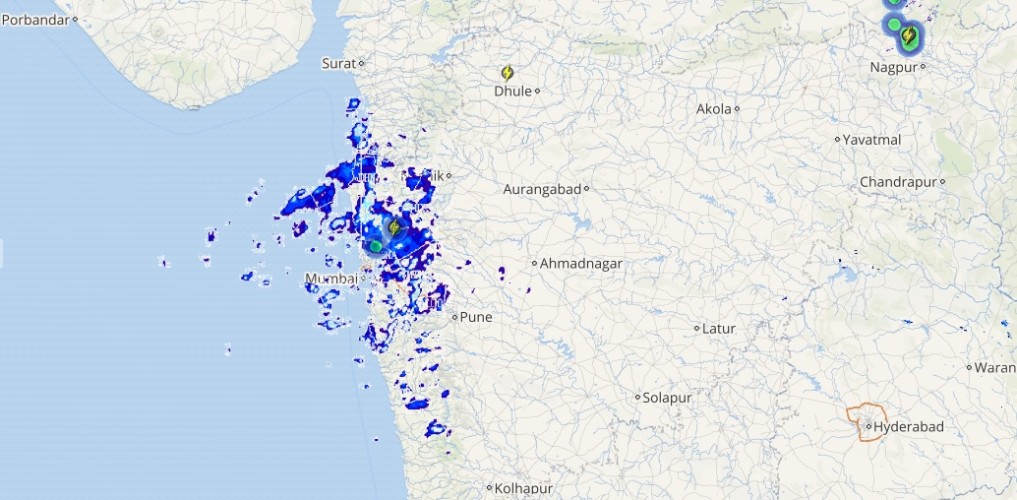
Live status of Lightning and thunder

During the next 24 hours, Southwest Monsoon will remain vigorous over Gujarat, Kutch and extreme South Rajasthan while, active Monsoon conditions are likely over Konkan region including Mumbai. However, normal Monsoon conditions can be seen over Madhya Pradesh, East Rajasthan, extreme parts of Madhya Maharashtra hills of North India, Gangetic West Bengal and Jharkhand.
Monsoon rain intensity will reduce over East Uttar Pradesh, parts of Bihar, Tamil Nadu, Karnataka, Maharthwada, Assam and Arunachal Pradesh.
Please Note: Any information picked from here should be attributed to skymetweather.com


