The axis of monsoon trough that governs Monsoon rains over half of the country, has now shifted south. It is presently passing through Bikaner, Sawai Madhopur, Shivpuri, center of low pressure over East Madhya Pradesh and then southeastwards to East central Bay of Bengal.
This kept Monsoon active to vigorous over Kerala during the last 24 hours. Meanwhile, active Monsoon conditions were witnessed over Chhattisgarh, many parts of Madhya Pradesh and East Rajasthan.
Major rainfall contribution came from Wayanad in Kerala recorded 471 mm, followed by Palakkad at 214 mm, Valparai 171 mm, and Alwar 61 mm.
However, the countrywide cumulative rainfall refuses to decrease and remains stagnant at 10%. Similarly, all the sub-divisions of India also continue to be rain deficient. East & Northeast India is the highest rain deficient pocket by 25%. Meanwhile, Northwest, Central and South India are rain deficient by 4%, 5% and 4%, respectively.
Now for the next 24 hours, active Monsoon conditions will prevail over Kerala, Chhattisgarh, Madhya Pradesh and Southeast Rajasthan that would bring light to moderate rains along with few heavy spells over these regions.
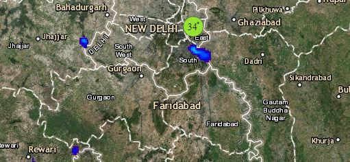
Click the image below to see the live lightning and thunderstorm across India
Normal Monsoon rains are likely over Konkan & Goa, Vidarbha, Jammu and Kashmir, Himachal Pradesh, Uttarakhand, parts of Jharkhand, Odisha, Sub-Himalayan west Bengal, Sikkim, Assam, Meghalaya and Coastal Andhra Pradesh.
Meanwhile, Monsoon will remain subdued over the rest of the country.
Please Note: Any information picked from here should be attributed to skymetweather.com


