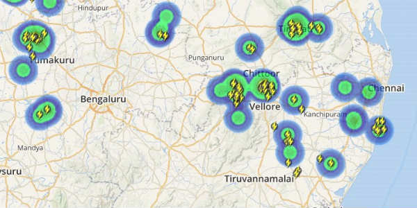
Chennai has been witnessing rain continuously from the past six days, however, intensity of rains were much less during the last 24 hours. The trough of low persists over Tamil Nadu and Coastal Andhra Pradesh. Another trough of low is persisting over Southeast Arabian Sea and adjoining Lakshadweep region. In wake of these weather systems, Northeast Monsoon remained vigorous over South of Chennai along the coast.
[yuzo_related]
On Saturday, Minambakkam observatory in Chennai witnessed 20 mm of rain, Nungambakkam observatory 9 mm of rain. Intensity of rains was more over south coastal region wherein Nagapattinam witnessed 120 mm rain, Karaikal 113 mm, Cuddalore 88 mm, and Puducherry 56 mm.
Now, the rainfall activity is likely to shift further towards north again. Thus, the affected areas will be Chennai, Cuddalore, Nagapattinam and Kanchipuram during the next 24 hours, which may see moderate to heavy rains. Rains are likely to peak during the night hours. Moderate intensity winds are also expected to affect the state.
Check out the live lightning and thunderstorm status across Chennai
Thereafter, the rainfall activity is likely to reduce. The interior parts of the state will receive mainly light with isolated moderate showers. Due to the upcoming showers waterlogging will once again intensify and people would continue to battle traffic jams and may be flash floods at few places.
Please Note: Any information picked from here must be attributed to skymetweather.com


