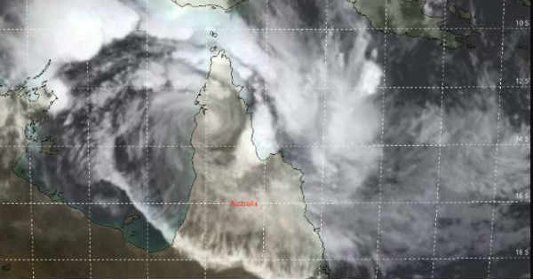
Two tropical cyclones are hovering near Australia and they both threaten to bring in severe weather to the nation’s tropic in the second half of this week. Severe Tropical Cyclone Trevor made landfall on the Cape York Peninsula on Tuesday and weakened to Category 1 storm. It is expected to plow westward into the Gulf of Carpentaria, threatening parts of the Northern Territory later this week.
It is at present centered at 13°S and 142°E. Despite of remaining in Catetory 1 system, it punched with a windspeed of 170 kmph.
Trevor is expected that it would continue to weaken into a tropical cyclone before entering Gulf of Carpenteria. In a span of 48 hours, it would re-intensify to Cat I-IV as it moves into the northwest of Gulf of Carpentaria. The vertical wind shear is low and the sea surface temperatures (SSTs) are somewhere between 30°C-32°C which are highly favourable for the intensification of the system.
Sea tides would begin to lessen along the east coast of the Cape York Peninsula on Wednesday while rough surf and high sea tides would be seen across the eastern Gulf of Carpentaria. As Trevor strengthens over the Gulf of Carpentaria, sea will become increasingly dangerous from Thursday into Friday.
Impacts ranging from storm surge flooding to damaging winds, flooding, power cuts and travel shutdowns are all possible from Friday night into Sunday.
Tropical Cyclone Veronica which is in the open waters of Indian Ocean after attaining the Category III strength will possibly reduce to Category I. As per the experts, it is expected to make a landfall in the coastline of Great Sandy Desert which is to the extreme northwest coast of Australia.
Also Read: Cyclone Trevor to make landfall anytime soon, heavy flooding and rain in offing
Image Credit: METOC
Please Note: Any information picked from here must be attributed to skymetweather.com


