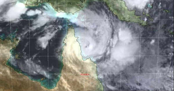
Cyclone Trevor moved slowly westward with a speed of less than 10 kmph and is presently stationed at 13°S and 144°E. It is still in the open waters having a punch with very strong winds nearing 200 kmph.
From tropical storm to Cat II it has undergone rapidly intensification. The experts have to say that an oblong eye has been formed that is considered less strong in comparison to small and clear eye. However, it will be of strength Cat II carrying enough damaging potential and is expected to hit around 1600 hours as per their local time. The storm is expected to weaken to a Cat I system as it crosses the Cape York Peninsula and would even weaken into a Tropical Storm before entering the Gulf of Carpentaria. However, in a span of 48 hours, it would re-intensify to Cat I-IV as it moves into the northwest of Gulf of Carpentaria. The vertical wind shear is low and the sea surface temperatures (SSTs) are somewhere between 30°-32°C which are highly favourable for the intensification of the system.
It is expected to take four more days to hit the Gulf of Carpentaria. While it is too early to take any call on the exact location and time of the landfall.
The residents are advised to prepare by securing boats and property, and to stock up on essential supplies including food, water and medication. The storm is expected to bring heavy rain and flooding to a large swath of the Cape York Peninsula as it slowly tracks westward into Wednesday.
Image Credit: METOC
Please Note: Any information picked from here must be attributed to skymetweather.com


