Major Hurricane ' Gabrielle' Tracks North Atlantic: No Threat To US East Coast

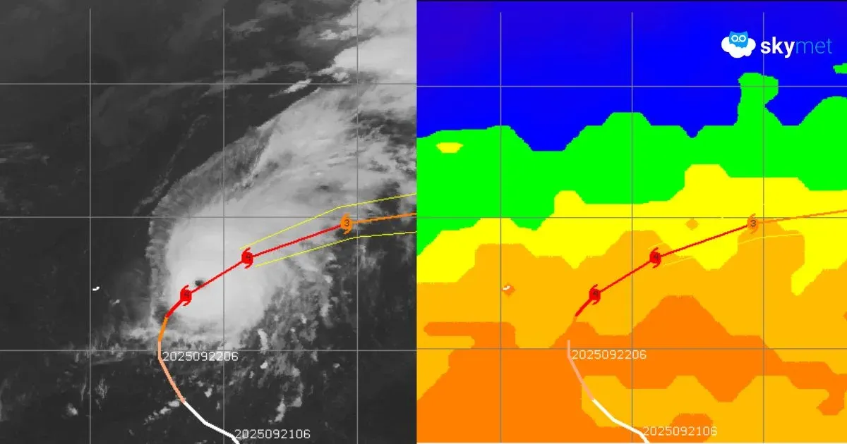
Satellite Image, Courtesy: CIMSS
The tropical storm Gabrielle rapidly intensified over warm waters in the Central Atlantic, becoming the season’s second major hurricane. Earlier, Hurricane Erin took advantage of that warmth, becoming one of the fastest-strengthening Atlantic hurricanes on record when it hit Cat-5 status in mid-August. Right now, much of the Atlantic basin has plenty of warmer-than-average waters for prospective storms. The Atlantic hurricane season has been a dampener and, despite warm waters, not many named storms formed. The season hit a September speed bump when the storm peak passed without a named storm for nearly one month.
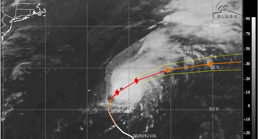
June is when the six-month-long season begins, but the true bulk of hurricane activity occurs from mid-August through September and into the first half of October. This season was running close to empty when the Atlantic should have been bubbling with storms. Erin and now Gabrielle saved face by recording at least two major hurricanes. But both these hurricanes quite conspicuously stayed away from the coastline. The eye of Hurricane Erin was never closer than about 200 miles from the U.S. East Coast, and its center never made landfall. The same is likely to be the case with Gabrielle, which is likely to steer away from the coastline, keeping a much safer distance than its predecessor Erin.
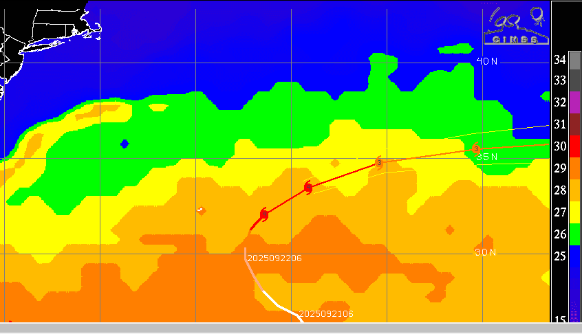
Hurricane Gabrielle has a very sharp circular eye, indicative of its intense potential. It is likely to retain its force for another 24 hours and start weakening thereafter. The hurricane could trigger “dangerously high waves and currents” along the U.S. East Coast from North Carolina onwards. The hurricane skirted east-southeast of Bermuda, when centered around 180 miles away from the island, and is now moving north-northeast at a speed of 25 kmph. After sailing over the open Atlantic Ocean and undergoing weakening, Hurricane Gabrielle is likely to head towards Europe, and its remnants could impact the UK in the coming days. The hurricane is not expected to cause primary damage across the UK, but the remnants could lead to a wet and windy weekend in some parts of the country.
There are two more disturbed areas in the Central Atlantic with the potential to become the next named storm. Atmospheric and oceanic conditions are becoming increasingly favourable for development. The next named storm is quite likely in the Central Atlantic very soon. Must Read: Hong Kong Prepares For Super Typhoon 'RAGASA': Chinese Coastline Face Deadly Risk